
Project description

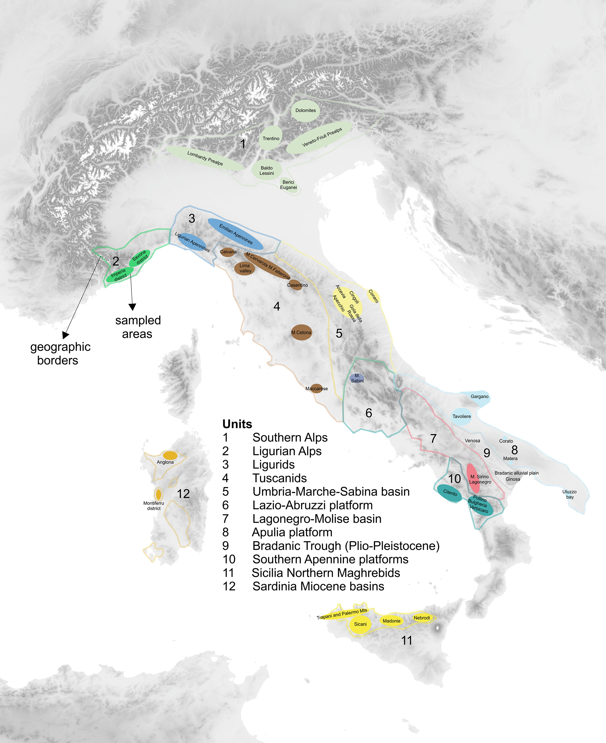
Knappable rocks have been key resources for prehistoric communities. In order to reconstruct their exploitation in the past, mapping outcropping areas and characterizing the different lithotypes has become compelling.
OPENLIT represents a crucial step in improving the knowledge of the lithic formations outcropping in Italy and will be an important milestone in the study of the availability and use of lithic resources during prehistory in Italy. It will have an important spillover effect on the study of technological skills, economic strategies, human mobility, and exchange networks.
OPENLIT aims to create the first Italian open access lithoteque, a comprehensive repository of knappable rocks. This collection will be supported by a multifaceted GIS geodatabase, serving as an indispensable resource currently absent in Italy. OPENLIT will devise a standardized analytical framework for characterizing knappable rocks based on laboratory testing, providing access to the scientific community via an openly accessible repository to facilitate data sharing and dissemination.
Compositional and petrographical characterization of selected chert sources will provide target values to establish reference groups for further comparisons with archaeological samples from prehistoric sites in the Italian peninsula and neighboring territories. Further experiments will be performed to quantitatively assess the properties of raw materials in relation to knappability and wear resistance. The project also includes the development of a shared protocol for describing samples stored in lithotheques. This protocol will be proposed as an international standard.
A significant role is played by some stable Italian lithoteques surveyed within the Italo-French Galileo project. They constitute a valuable comparison tool for provenance studies of archaeological finds, and they show heterogeneity in terms of geographical coverage, geological age, number of pieces, level of documentation and characterization.
Last update
29.01.2026