
Methodology

Data will be analysed at a national level with a shared approach combining different methodologies:
- organization and standardization of previous data from geological collections, descriptive protocol development and Database design and creation, following a relational architecture and SQL language. The design and the progressive entry of data will be done in collaboration with LIEC (Interdisciplinary Laboratory on Cultural Heritage) of the University of Florence. The OPENLIT DB will be hosted at the UniFi server, under the management of the SAGAS Department and accessible at the webpage https://www.ereditaculturali.sagas.unifi.it/
- Chert sample selection based on these criteria: archaeological importance, certainty of location, maximum population variability, sample’s material quality and quantity. Compositional and petrographical characterization of selected chert sources will provide target values to establish reference groups. Further experiments will be performed to quantitatively assess the properties of raw materials in relation to knappability and wear resistance.
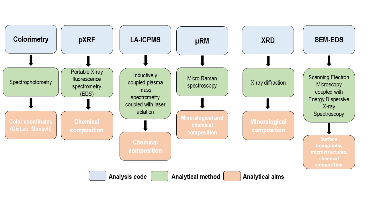
- Analysis by expert petrologists, sedimentologists and micropalaeontologists involved in OPENLIT using a multianalytical protocol shared by the two Research Units. The analytical protocol involves non-destructive macro/microscopic, geochemical and mineralogical analyses. The standardization of procedures and the instrument calibration is necessary to ensure data comparability.
- Database conversion into a geodatabase with an easy-to-access WebGis platform, available to both scholars and non-specialists. The geoDB will show sample’s location, archaeometric and geological information acquired from the analysis of samples and recorded in the OpenLIT DB. These data would be filter using different GIS tools to obtain thematic maps. This action will be performed with the technical and scientific support of the Centre for Geotechnologies (CGT) of University of Siena and by ISPRA, thanks to detailed geological maps that will be provided. The geoDB provides a basic tool to develop future project implementations, both with data from the analysis of new geologic samples and archaeological collections.
Last update
29.01.2026